|

Elands Bay offers great surfing with left-breaking waves and the
beach just begs to be explored, walked, run or played on - it is vast with many rocky sections ideal for exploring. The
village retains the charm of less development so appeals to those looking for
a relaxing beach holiday with nothing more than sea, surf, sand and perhaps a
crayfish or two to while away the sunny days. Surfers have named the village E-Bay apparently and revel in the fact
that it is not as busy as the more famous J-Bay (Jeffrey's Bay)
 | | Rocky shores Elands Bay |
The town has a North and South Side divided by Verlorenvlei, an important
wetland for wading birds.
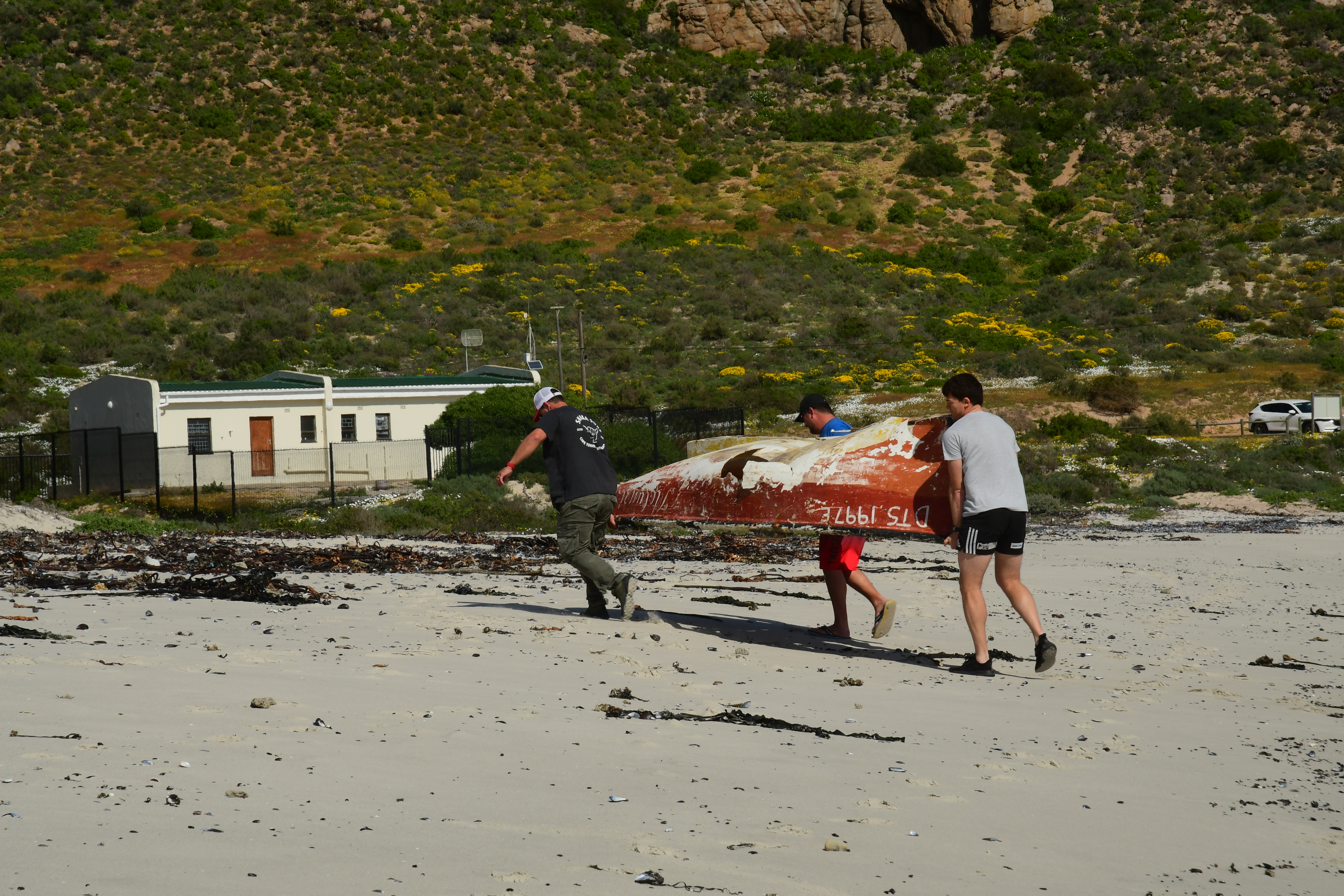
During
our beach walk we chanced upon an old rowing boat. These always beg to be
photographed while lying in the dunes so we did this from all angles - just
for fun and because it was there. Imagine our surprise on our walk back to
find that it was being lifted, prodded and then carried off way down the
beach to find a new home! Can we call it "upcycling"?? Anyway, hopefully, this old boat will bring joy to it's "new" owners. It certainly made the guys puff and pant before they reached the path to the newly built house.  | | Upcycling and old rowing boat! Elands Bay |
 | | Marital Argument between seagulls! |
The next village on our trip was Paternoster. This is a very popular village that has expanded hugely over the past years. The long beach is ideal for walking or jogging. Watching the fisherfolk return with their catch of the day is always a sight to see. There are a number of restaurants in the village, facing the beach plus those situated at Paternoster Wharf. During busy times, do make a booking to avoid being left hungry. The village has many quirky shops, galleries and activities if you are staying longer than a week-end. For beer lovers, a visit to the Paternoster Brewery is a must! https://stayinpaternoster.co.za/the-ultimate-paternoster-bucket-list/  | | Paternoster |
The Cape Columbine Nature Reserve is just outside of Paternoster. This reserve covers an area of 263ha and was declared a reserve in 1973. Braai and camping facilities are situated at Tietiesbaai. Closer to nature and the sea you cannot get. It's very popular yet retains the totally unspoilt ambience.
The Cape Columbine Lighthouse was built in 1936 - it remains the last manually controlled lighthouse built in South Africa. Built on Castle Rock this light is the first seen by ships arriving from Europe and the beam reaches 50 km.  | Local fishermen Paternoster
We stopped in Citrusdal to break our journey and headed into the Cederberg on a cloudy, cold, misty day. The Cederberg offers numerous hiking trails, rock art, incredible rock formations and it truly is a wilderness area of note.
The Stadtsaal Cave area (permit required) offers a glimpse into the lives of the previous !Xam (San) people and it's quite eerie walking these paths and gazing at the immense rock formations and caves. The wind whistled through some of the caves on our rainy day visit and I could just feel the cold that the San must have tried to ward off with their fires and animal skins.
It is incredible that their rock art, mainly of elephants, has survived to this day.
|
 | | San Rock Art Cederberg |
 | | Rainbow on road to Nieuwbrew Craft Brewery |
There are 3 Wine Farms in the Cederberg
area but we fancied some Craft Beer. The Brewery is called Nieubrew and is
signposted from the road. Unfortunately, the distance is not shown, neither is
the fact that it becomes a single track in places! Anyway, we headed up the
gravel road, seeing the most beautiful rainbow. Suddenly, the road became very
narrow and a bakkie was approaching from below. Oh my word - what to do now on
this muddy, slippery single track? Panic struck and we came to a dead halt! The
other driver, obviously a local, waved and started reversing downhill at quite
a speed. I was pertrified that he would go over the edge but he managed to
reverse a long way down to a turning spot. We thanked him and asked if the
valley below had another road out. With a firm shake of his head, he stated
that we would have to come back the same way. We could see the brewery way down
below in the valley but the thought of having to negotiate passing another car
on the return journey, was too much to contemplate. So, scaredy cats that we
are, we turned at the same spot and headed up back to the main road. We tried
to stay close to the local guy so that we didn't have another problem! So
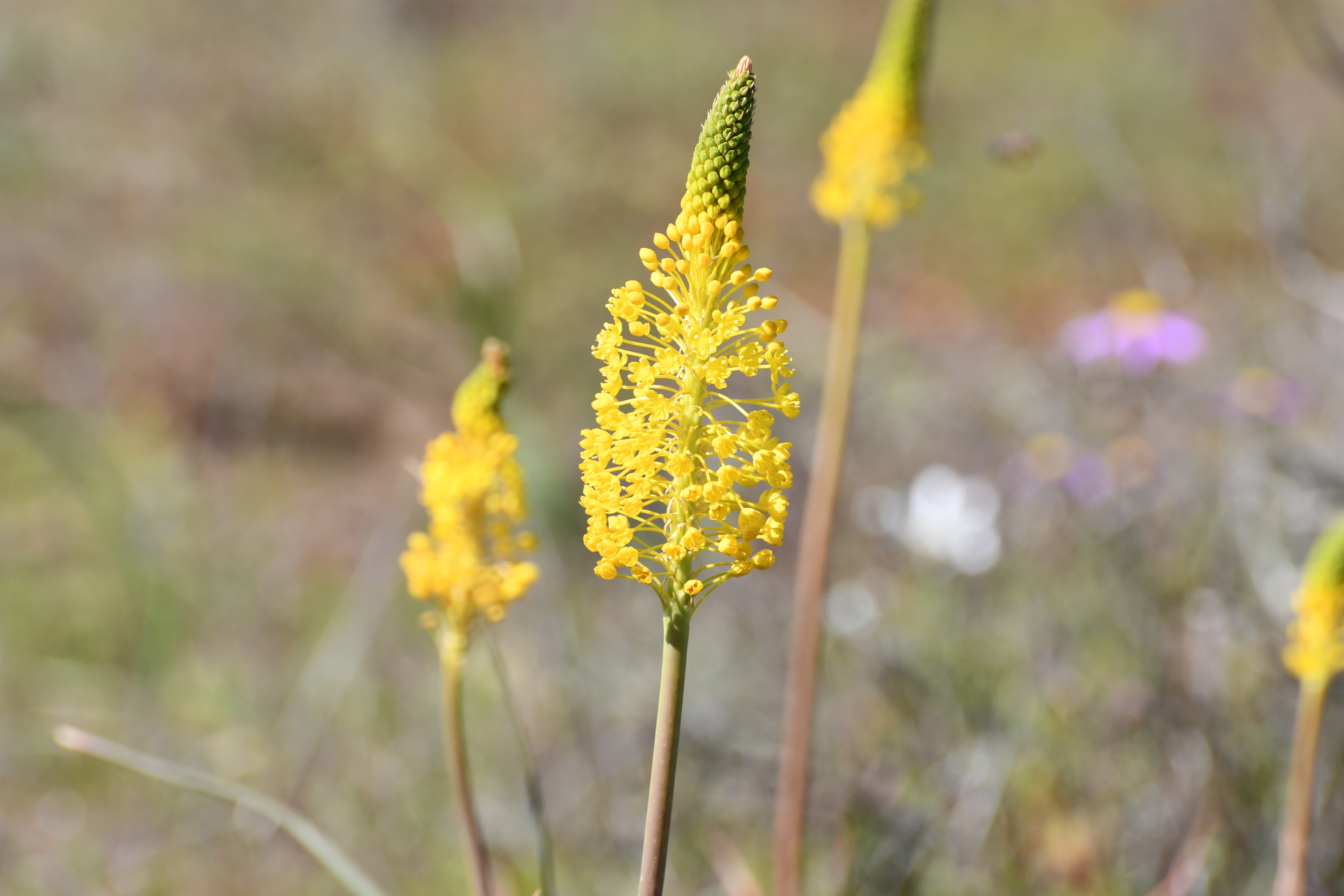
sadly, no Craft Beer on this occassion. During the summer months, the road would
be dry and not quite so scary - perhaps another time!! And now for some serious flower viewing The Biedouw Valley is reached via
Clanwilliam and the Pakhuis Pass This is farming area and is not even
really a village. It's fame is purely because of the incredible flowers that
bloom during the months of July to September. Walking amongst the fields of flowers
was very beautiful and with the mountains in the background, it remains a
special spectacle during flower season. The farmers move their livestock during
this time to allow the flowers to be enjoyed by thousands of visitors each
year. We had a day of rain and cloudy
conditions but the drive was still worth the effort, depsite blinding rain at
times heading back over the Pakhuis Pass!
|
|
|
Biedouw
Valley via Pakhuis Pass
|
Niewoudville is reached via Vanrynsdorp Pass. This pass is considered one of the top 10 passes on the Northern Cape. The Pass straddles the boundary of the Western and Northern Cape - Vanrhynsdorp being in the Western Cape and Niewoudville being in the Northern Cape. The pass is part of the R27 with a short climb of appox.8 km to the summit 825 m above sea level. The valley below stretches forever.
It is a stunning pass with hairpin bends so take care and stop only in the dedicated stopping places.
Niewoudville remains one of the
best sites for flower season viewing. The farmers open their farms to the public
and offer refreshments and friendly banter!
Our first farm was Boereplaas and the
owners were worried that our car would get stuck on the muddy roads but we were
fine. It had rained much the previous day so all gravel roads were pretty
muddy. Each farm that we visited was different so it was the right choice to do
all 3 farms on our 1st day in Niewoudville.The town of Niewoudville lies on the
Bokkeveld Plateau where Cape Fynbos meets the Hantam Karoo. The fields of flowers are as far as the
eye can see but one also has to look for the smaller species that are
incredibly beautiful.
Matjiesfontein Flower Route is 14 km
south of town and offers a circular drive where one can only marvel at the
immense fields of flowers as far as the eye can see. Papkuilsfontein is 23 km outside town
and has 2 short routes - look out for the smaller bulbs on this route.
A stop not to be missed is the Hantam
Botanical Garden. Whilst this does not immediately grab one's attention in
offering huge fields of flowers it does offer 9 hiking routes, varying in
distance, and the flora is more specific rather than fields of flowers. Look
out for the tiniest of plants - they are incredible. The Hiking trails as as follows: Spiderweb Trail - this is a short walk near the entrance of the gardens. The Blue Cranes (National Bird of South Africa) love to visit this area during flowering season. Gifbol Trail - 4.3 km - this area is where grey tillite and red dolomite soils meet. The many bulbous plants are dormant during the hottest months so nothing of the bulbs, corms, rhizomes or tubers will be visible above ground. Porcupine Trail - 3.5 km - there are approx.8 porcupines per square km in the garden. they eat huge quantities of bulbs, however, this assists to maintain the quantity of the bulbs due to select foraging. Look out for the large porcupine burrow. Aandblom Trail - 2km - the sweet scent of the moth-pollinated plants may only be smelled in the late afternoon, early evening when the moths become active. Camel Koppie Trail - 6.2 km - this trail flattens as you leave the Renosterveld . A clear view of the dolerite koppies can be seen from this trail. The soil here swells in rainy weather and shrinks in the dry season so it is dominated by well-adapted annuals. Renosterveld Trail - 3 km - this trail runs in a loop taking you through the Tillite Renosterveld Steenbokkie Trail - 3.3 km - this is a trail to spot the shy and solitary Steenbokkie who feed all day except during the hottest time when they can be spotted lying under bushes. Dolerite Trail - 8.2 km - this wanders amongst the beautifully balanced rocks of the dolerite koppies. Dolerite beds were formed when lava erupted across the southern African landscape. (180 - 135 million years ago) Butterfly Trail - 2.5km - look out for the MacGregor's Blue butterfly. This is the only section of the park when it can be spotted. Some history of the Hantam Botanical
Garden "The farm
Glenlyon forms the core of the new Hantam National Botanical Garden". "In 1960 Glenlyon started flower tours on the
farm, hiring the only bus in Nieuwoudtville. In 1991 an old Bedford bus,
seating 25 people, was purchased and it has become quite legendary in the
ecological world. The tours rapidly became very popular and ultimately a
45-seater bus, pulled by one of the farm tractors, was purchased. In 1991 the BBC Natural History Unit approached
Neva and Neil in connection with the filming of The Private Life of
Plants. Excellent rains fell in 1993 and the team stayed on the farm for
three and a half weeks. In January 1994 Sir
David Attenborough returned with the team again to photograph the area during
the dry season. The Director of Kew Gardens, Sir Ghillean and Lady Anne Prance
visited the farm on two occasions. Sir Ghillean’s commented that “This farm is
a botanical treasure of international importance.” "As none of Neva
and Neil’s four children wanted to farm, Glenlyon was sold to SANBI in 2007 and
has now become the ninth National Botanical Garden managed by SANBI."
The town of Nieuwoudtville has a number of sandstone buildings - check
in at the Information Office for more info on these plus the best flower
routes. This town is known as the "Bulb Capital" of the world with
1350 species found along the Bokkeveld plateau. The NG Church above is of of the few remaining Tafelberg Sandstone
buildings. The Neo-Gothic Style church was built in 1906 and opened in 1907.
Whilst in the
Nieuwoudville area, do take a side trip to view the Niewoudville Falls, just
7km north of the town. The gorge offers impressive views and the drop of the
falls is 90m. The paths go both ways - check them out for differing views of
both the falls and the deep gorge. The falls are on the Doorn River.
The Quiver Tree Forest is 25 km north of the town, along the R357 - this is the largest Quiver Tree forest in the world and the southernmost concentration of trees. The farm is on private property and there is a charge for photography after 18.00 hrs. Gannabos does offer accommodation if you wish to treat yourself to some night photography - the is then free for those staying on the farm.
After viewing flowers for days, we decided to head to the coast for a slight change of scenery. The town of Lutzville boasts the Sishen-Saldanha Railway Bridge over the Olifants River. This was completed in 1975, is 1035 high, it is supported by 22 pillars that each extend 45m into the river bed. Rather impressive! A bonus would have been the sighting of the train itself but as we did not have a time-table, this was not to be. We have seen the train previously, at 375 wagons it goes on and on and on....! The viaduct is pretty impressive and this is just a small part of the 861km journey between Sishen and Saldaha Bay. There are no passengers just tons and tons of iron ore.
Next up was the stunning beach at Strandfontein. The small seaside village, mainly holiday makers homes, is situated at the mouth of the Olifants River, it's wide and ideal for long walks or runs. There is an NSRI Station and swimming between the flags is recommended during the summer season.
After a long walk, we decided that perhaps some lunch was called for. So we headed towards the very tiny fishing village of Doring Bay. First established as a crayfish packing factory, from 1925 onwards but this closed in 2007. Abalone is now farmed here. The farm was established in 2011. It's a long and involved process - from spawn to market ready at 90g to 120g takes approx. 40 to 48 months. The sea water is tested 3 times per day. A wonderful initiative and a great source of employment in this tiny fishing village.
Fryers Cove Winery and the Jetty Restaurant are situated at the harbour. Enjoy the sound of the sea, fresh air, simple menu at this friendly outdoor restaurant.
Only wine is sold, no beer - be warned! 
The Olifants River Estuary was our next stop. Whilst there were not many birds when we visited it is a favourite spot for many migratory birds during the summer months. With only a few rowing boats, a few birds and a chilly breeze, this is a place for silent contemplation of life or perhaps a braai on a sunny day! There is also a hiking trail between Doringbaai and Papendorp for those with more time and energy.
Papendorp, originally called Viswater (Fish Water) is a tiny village of locals, all enjoying the sunshine on a quiet Sunday afternoon. The Labyrinth of Memories" was built by local folk in gratitude for the past, their ancestors and with hope for the future and our children. It was built with stones from the original "Viswater House" of Lady Fryer. Being flower season the labyrinth was bright and cheerful. So often, the best surprises are on the "roads less travelled" - this labyrinth, the villages of Doring Bay and Papendorp were certainly worth the detour.
Next up - Lamberts Bay At first glance Lamberts Bay appears to have just a small harbour and a few factories. Further exploration revealed a huge beach to the north where a couple had braved the winter chill and were surfing. The waves were pretty fierce so surfing here is not for the feint-hearted. Flamingoes were spotted on the far banks of the river. To the south of the town, the coastline is more rocky so there is a tidal pool for safe swimming. Here the homes are very impressive and line the beachfront - many of them offer Self-catering apartments.

Most visitors to Lamberts Bay come to see Bird Island. This is the most accessible Cape Gannet colony in the world. World population is approx.250,000. Cape Gannets have a wingspan of 1.8m and an average weight of 2.5 kg. They range as far as Mozambique as well as West Africa. Bird Island is one of only 6 breeding sites worldwide and the only one accessible to the public so it truly is a magical place. Watching these incredible birds is totally fascinating and the centre has information available on their different "poses" such as Bill Scissoring and Mutual Preening. This reduces tension between partners and it seems to happen all the time. Gannets certainly believe in safety in numbers. The Cape Fur seals are enemies and these could be seen sunning themselves on the rocks! With over 17,000 gannets within reach, it is a seal's favourite take-away! And those beautiful blue eyes.....I could watch them all day long. Bird Island will be empty during the months of May/June/July when they are further north so plan your visit accordingly.
The final leg of our journey took us from Lamberts Bay to Citrusdal and then onto the R303 to Ceres. The road has approx. 30km of gravel, two beautiful and scenic passes and farmland for most of the way. The Middleberg Pass (Built 1994) Altitude 1071m and then the Gydo Pass (built 848, reconstructed 1938) Altitude 866m takes you down into Ceres. The Gydo Pass offers the most spectacular views of the Ceres Valley below and is incredibly beautiful whatever the season.
Just a day after we left to head back to Cape Town, snow fell in Ceres and the mountains looked like a scene from Europe! Oh well, we had to get back home sometime.
South Africa offers so many routes, so much to see, so many "road less travelled" experiences, it takes a lifetime to explore.
Until next time,
For Accommodation Cape Town, South Africa
|