Popular Posts

15 October 2020

Cape Town - Walking Slangkop to Long Beach, Kommetjie

With brilliant sunshine on a spring day in Cape Town we decided that one of our favourite walks was calling! Park at Slangkop Lighthouse and set off on the board walk. Dogs are welcome but you need to have a valid Dog Walking Wild Card and please do remember to pick up any poo!


"The Slangkop Point Lighthouse in Kommetjie has a long history dating back to 1914 when it was scheduled to be completed. When World War 1 broke out, the completion of the lighthouse was pushed back and it was only completed in 1919".


There are numerous Memorial Benches along the path, set at scenic spots, so these are ideal if one just needs to rest awhile, smell the sea air or juts take a moment to "be" It's that sort of area - great to restore the soul and enjoy the calming atmosphere on most parts of this walk. It does get busier towards the beach area during the summer months..


  • It is the tallest cast iron lighthouse in South Africa
  • It is part of the Marine Protected Area of Table Mountain National Park
  • Although fully automated it is one of the few lighthouses in the world that is still manned by a lighthouse keeper or officer.


" In May 1900 the Kakapo was on its maiden voyage from Wales to Australia, when in poor visibility the captain mistook Chapmans Peak for Cape Point. The shipwreck was part of the movie backdrop for the 1960 's movie Ryan's Daughter"

Whilst the movie was shot in Ireland on the Dingle Peninsula, bad weather resulted in many scenes being shot in Cape Town!


Whilst the area near the slipway and small beach are busy, most of the walk towards Long Beach is an ideal spot for watching the various water birds. Feeding on the insects in the kelp is a huge attraction for the birds and there were plenty of bugs crawling around the seaweed! The birds are very welcome to catch all those little critters!


The Mountain views are so beautiful as one heads towards Long Beach - the sea here is enjoyed by stand up paddlers, surfers, canoeists and swimmers. Although, bear in mind, that the water is pretty chilly. Not everybody can be like Lewis Pugh who manages to swim in so many seas around the world with much colder temperatures than the waters of Cape Town. 


Now juts imagine that these short steps would take you into you beautiful seaside home - so close to the sea that stormy weather could perhaps be a problem! The homes along this stretch enjoy magnificent views across the bay.


Long Beach stretches for 8 km at the end of this wander - soft white sands as far as the eye can see. We stopped at the start of the beach and returned to our car parked near Slangkop Lighthouse.

For those who enjoy camping you can try the Slangkop Tented Camp set under Milkwood trees. It's just a hop and a skip to either the path to the beach or to the shops in the village.

Then the sunset can be enjoyed with a glass of wine without having to drive back home again!


And just like that, the path ends at Long Beach - enjoy!

For Accommodation in Cape Town:

www.bradclin.com


20 September 2020

South Africa - Franschhoek, Western Cape


Babylonstoren - Franschhoek Western Cape 

 Living in Cape Town has the added benefit of all the Western Cape beauty on our doorstep, with many day drives available.  It is sometimes difficult for us, as locals, to decide what to do on a gloriously sunny day. So many choices! Even after living in Cape Town forever!

Anyway, today we chose to head out to the winelands of Franschhoek, then do a circular drive back via the Theewaterskllof dam to Cape Town.

There are very many wine farms in the Franschhoek area and we would recommend that visitors try the Franschhoek Wine Tram for an exciting experience. With a number of routes to chose from, view their website:  www.winetram.co.za  There is a ticket office in the Main Street - very visible. 

The Franschhoek valley is one of the most beautiful in the world. The French Huguenots settled in this valley over 300 years ago and brought their knowledge of winemaking with them. The tradition lives on in this quaint village and surrounding wine farms.

Franschhoek Valley from the Franschhoek Pass 

Today we chose to wander around the gardens of Babylonstoren - there is a small entry fee and the farm is extremely popular. There is also much to explore so do allow sufficient time to wander the farm at your own pace. Garden tours are available, there is a Spice House, a Farm Shop, restaurants, wine tasting and even an onsite hotel! Bookings for the restaurant "Babel" should be made in advance while the Green House is on a first come basis. Shady walks, benches in tranquil spots, an amazing display of clivias (September), Cycads, Guava Avenue and much more.

Babylonstoren Farm Franschhoek Western Cape 

For a brief lunch, we decided to try a local brewery, Franschhoek Beer Co a try. One can enjoy a beer tasting or just try any of their beers. Sitting in the brilliant sunshine, listening to a mellow jazz trio in pleasant surroundings was a treat. For beer lovers, it's a must stop!

Franschhoek Beer Co 


We headed out of the village to Mont Rochelle Nature Reserve at the top of the Franschhoek Pass where we watched in awe as the paragliders took off to fly high over the stunning Franschhoek valley below. Fun for both old and young, it's a must try for those of you with an adventurous spirit!
www.winelandsparagliding.co.za
On a clear day, you can see as far as the Theewaterskloof Dam where we were headed next. 


Paragliding Mont Rochelle Franschhoek Western Cape 

Mont Rochelle Nature Reserve is extremely popular with hikers and the reserve offers a number of trails, varying in length. With stunning scenery, choose a short or longer day trail. There is an entrance fee at the gate and parking is free. The Reserve forms part of the UNESCO Cape Winelands Biosphere so the plant life and scenic views are well worth your time.


As we headed down the Franschhoek Pass and it's hairpin bends (not too many!!) we looked forward to another visit to the Theewaterskloof Dam to measure the increase in the dam levels after our much needed winter rainfall. This earth-fill dam lies in the Villiersdorp district and on the Sonderend River. It was opened in 1978 and is the largest dam servicing the Western Cape with a capacity of 480 million cubic meters. During out horrendous drough of 2017 when Cape Town nearly reached "Day Zero" this dam was only 12.9% full. Today is stands at over 94% so it's wonderful to rejoice at this water level and the scenic beauty of the dam. It is a photographers dream location.

Theewaterskloof Dam Villiersdorp Western Cape 

On the way back, do stop at one of the farmstalls on the N2 for tea and cake or something more filling before heading back to Cape Town. A perfect day out.

Theewaterskloof Dam Villiersdorp Western Cape 


01 September 2020

South Africa - Waylands Wild Flower Reserve, Darling


The Wild Flower season along the West Coast and further inland, brings many visitors each year.

The Wild Flower season normally is August and September of each year.

The floral display does depend on good rains during winter so in the years of drought, the flowers are not at their best.

A beautiful farm to visit is Waylands Wild Flower Reserve, near to Darling, South Africa

The drive inside the reserve is circular and the flowers this year are spectacular - don't miss the window of opportunity!

Waylands Wild Flower Reserve

"The Waylands wild flower reserve was started by Frederick Duckitt in the early 1900’s. Visitors have been allowed access to the spectacular spring display of approx 300 species of wild flowers every season since then. The road allowing visitors to drive through the reserve was built in 1938 by Wilferd Duckitt. The wild flowers are at their best from about the last week of August to the end of September, with the peak being in the first 2 weeks of September."


Waylands Wild Flower Reserve

"The flower reserve forms an integral part of Waylands’ farming activities, and is actively grazed by cattle and sheep from the time the seed has set in late November to the end of April before winter sets in. This grazing strategy has been used by the local inhabitants of the Cape since time immemorial, and we have found that this practice, which allows the animals to actively spread the seed, in addition to occasional autumn burning of the veld every 15 years, is imperative in promoting the growth of the wild flowers"

We can testify to the fact that cattle graze these fields during the other months of the year - there were many dried cow pats around!


Waylands Wild Flower Reserve

"Waylands has porcupines, caraculs, wild cats, genets, mongoose, red meerkats, bat eared foxes, Cape silver foxes, honey badgers, steen bok, duikers, Cape clawless otters, and many more"

As we visited on a busy Sunday, we did not see any animals - however, they have an amazing habitat to enjoy during the quiet months when there are no visitors!


Waylands Wild Flower Reserve
.
One is allowed to get out of the car to view these beautiful flowers up close.
Please take care when parking and walking so that the flowers are not trampled.


Waylands Wild Flower Reserve 


Being a working farm  the owners also run 800 Merino sheep on Waylands. The first Merinos outside of Spain were brought to the Darling area in 1789.    Merinos are a dual purpose sheep with their wool and meat being of superior quality and are well adapted to the area.


Waylands Wild Flower Reserve


"Waylands also have a herd of Nguni cattle This indigenous African breed is identified by their multiple patterns and colours. Each animal in the herd is individual in the combinations of its colour pattern, horn shape, gender, status and history.
The Ngunis are hardy, adaptable, fertile and able to survive in conditions inhospitable to other breeds. They are resistant to drought and tick-borne diseases. They are heat tolerant and, being non-selective browsers and grazers, can obtain optimal nutritional value from the available natural vegetation. They are also tame, yield good beef and their skins are highly sought after".
Waylands Wild Flower Reserve


Waylands Wild Flower Reserve

Waylands Wild Flower Reserve

Waylands Wild Flower Reserve

Waylands Wild Flower Reserve

Waylands  Wild Flower Reserve

Information on the farm is supplied by www.waylands.co.za
Photography: Judelle Drake


26 August 2020

Cape Town - Cape Point

Cape Point offers so much more than just a quick visit to the "old" lighthouse!
1860 - 1919

Fishing in the Cape Point Reserve is a favourite pastime with local Capetonions, no matter what the weather!


Whilst it is a "must" to get to the top of this iconic lighthouse, do allow time to enjoy the entire park.

If the Flying Dutchman Funicular is not operating, then it is quite a climb. But very well worth it.


The views are spectacular with the cliffs at the southern point towering 200 metres above the sea. Look out for all 3 - Cape of Good Hope, Cape Point and Cape Maclear. It was fascinating to watch the birds on the cliffs in the photo below - for more info on the sea birds of Cape Point, see the very interesting article below:

http://www.10000birds.com/seabirding-off-cape-point.htm


The "new" lighthouse stands proud on Dias Point (see photo above) and is one of the most powerful on the South African coast. With a range of approx. 60 kms, all ships should be safe rounding the Cape.

Beaches & Tidal Pools within the park:

Bordjiesrif  offers a lovely tidal pool and braai/picnic places

Bordjiesrif Tidal Pool Cape Point South Africa

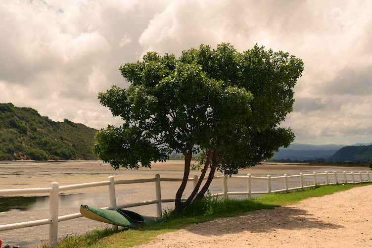
Buffels Bay boasts a stunning beach and also has a tidal pool plus braai places


Tidal Pool at Buffels Bay Cape Point South Africa

With ostriches roaming close to the beach at times or baboons fighting over shellfish, there is always something for both adults and children to enjoy. Please keep a safe distance from baboons as they are wild animals and are attracted by food. It was wonderful watching them eating the mussels and very obviously enjoying every morsel!


The sand dunes at Platboom are also worth a wander or a hike.


Hiking

For hikers Cape Point is a dream - there are many hikes to choose from, from 1.5 hr round trips to overnight hikes.

The following info is: Courtesy of the Cape Point web site:
Photography - Judelle Drake

Lighthouse Keeper’s Trail

The Lighthouse Keeper’s Trail is often overlooked by visitors eager to pay a visit to the iconic old lighthouse atop Cape Point, but this short trail that runs below the well-known landmark should not be missed. The trail begins just behind the upper funicular station, and a narrow but well-established path will lead you along a sheer cliff-face towards the lesser-known new lighthouse. It offers a fascinating perspective of the old Cape Point lighthouse which towers many metres above, and it walks you through historical bunkers and beautiful fynbos until the path runs out, at what certainly feels like the very tip of Africa.
Departs: Behind upper funicular station. Park at the Cape Point main parking area and walk to the station or save energy and take the funicular.
Distance: +-2km, one hour return
Difficulty: Easy
Lighthouse Keepers Trail Cape Point
Cape of Good Hope Trail
The Cape of Good Hope trail takes you along a well-maintained and marked boardwalk towards the famous Cape of Good Hope sign, located on the rocky shoreline far below. The trail is popular for its accessibility, and for the unsurpassed views over the pristine Diaz Beach and rugged western shoreline. Make your way all the way to the very end of the trail, and you’ll have reached the most southern point of the Cape Peninsula – a perfect photo opportunity to prove that you’ve visited the most South Western corner of Africa.
Departs: Cape Point main parking area. Follow signs towards Cape of Good Hope.
Distance: +-3.5km, 2-3 hours return
Difficulty: Easy
Cape of Good Hope TRail
Antoniesgat Trail
Buffels Bay Beach is a gem hidden from the main tour groups, and the Antoniesgat Trail that departs from nearby offers beautiful views, a moderate level of difficulty, and the opportunity to cool off in the tidal pools, or enjoy a braai at the well-maintained facilities, at the end of the walk. The walk takes you close to the action where powerful waves pound the peninsula, and there are a number of caves and tunnels to explore en-route. The views over the bay, towards the mountains, and of course up towards the Cape Point lighthouse make this one of the region’s most enjoyable short trails.
Departs: Traffic circle south of Buffels Bay Beach
Distance: 3.5km, 2-3 hours return
Difficulty: Moderate

Gifkommetjie

The Gifkommetjie trail follows the south western shores of Cape Point, and offers beautiful views of the unspoilt shoreline, lush green dune vegetation and open pans and marshes. It’s a great option for the moderately fit looking to get some good distance on a flat route, but can also be shortened if you’re just looking to stretch your legs, away from the busier sections of Cape Point. It’s an often overlooked region of the nature reserve, and the result is a feeling of true isolation and escapism in one of the most picturesque locations.
Departs: Gifkommetjie parking area, follow signposts upon entry into Cape Point
Distance: +-5.5km, 2 hours return
Difficulty: Easy
Gifkommetjie Cape Point South Africa
Kanonkop
The Kanonkop trail, which is a 3 hour circular route departing from the visitor centre, is one of the most popular among Cape Point hiking enthusiasts. Named after the old canon located at its peak, the Kanonkop trail provides impressive views over False Bay, Cape Point, Buffels Bay Beach, and the prominent Da Gama monument, and it also passes an interesting old lime kiln along the way. The trail requires only a moderate level of fitness, but if you’re feeling less energetic follow the road to Venus Pools and park close to the signs directing you up Kanonkop, a few hundred metres after the turnoff at Bynes.
Departs: Cape Point visitor centre
Distance: +-5.5km, 3 hours return
Difficulty: Moderate
Da Gama Monument Cape Point South Africa
Phyllisia Circuit
The Phyllisia Circuit, named after the large trawler that ran aground on the nearby shoreline in 1968, also departs from the Gifkommetjie parking lot. This circular route takes you parallel to the western Cape Point coastline, and returns along the shore. This too is an often overlooked route, and even on busy days can offer beautiful Cape Point tranquility.
Departs: Gifkommetjie parking area, follow signposts upon entry into Cape Point
Distance: +-7km, 3 hours return
Difficulty: Easy
Shipwreck Trail
Perhaps the most popular of the shorter walks at Cape Point are the shipwreck trails. These unique walks depart from the Olifantsbos parking area, and each offer fascinating insight into the early days of the many Cape Point maritime disasters and access to unspoilt fauna and flora. Read our guide to the Cape Point Shipwreck trail for more information on what you can expect from each of these walks.
So, all in all,.a one day visit is never enough - do explore as much as you can and enjoy the various seasons in Cape Point.
Outlook points on the way to the old Lighthouse Cape Point South Africa

Ostrich Cape Point South Africa

http://www.flickr.com/photos/bradclinphotography

                For Accommodation Cape Town, South Africa
                                  www.bradclin.com


10 August 2020

Cape Town - Tygerberg Nature Reserve


The Tygerberg Nature Reserve offers beautiful 360 Degree views of Greater Cape Town plus the opportunity to hike, jog, stroll or picnic while listening to bird song and being in the fresh, perhaps chilly, air! 


The trails are well marked and mostly easy - the entrance is in Totias Street, Welgemoed, Cape Town (Northern Suburbs) and a GPS is recommended.


Wild Olive
Easy
Walk up the tar road from the Welgemoed entrance and keep an eye out for the turn off to the left. This path intersects with the Golden Mole trail.
Length: 210m


Tortoise
Easy
Follow the sign that turns off to the right of the tar road when you’re walking up from the Welgemoed entrance.
Length: 
1280m


Duiker
Easy
Duiker turns off from the Tortoise trail and circles around the triangular dam visible from the top of the hill. It’s a nice little tangent off from the main reserve.
Length: 
1600m


Watsonia
Easy
You can start this walk from either entrance. If you start at Welgemoed the first section is on a tar road that gently climbs up the hill. From here the gravel road winds down and then up onto the lower koppie.
Length: 2660
m


Induli
Easy
This routeis on the Platteklip side of the reserve. Follow the path from the entrance until it splits and then take the left path, this will circle around and meet up with Watsonia trail to lead through the picnic area and then back to the entrance.
Length: 990m


Ukhetshe
Easy to moderate
Also on the Platteklip side this path turns to the right where Induli goes left. From here it runs along the lower slopes all the way to the Welgemoed side picnic area and then onto the Watsonia route road all the way to the Platteklip picnic area and then back to the entrance.
Length: 3160m


Golden Mole
Easy to moderate
From the Welgemoed entrance follow the tar road until you see the sign leading off to the left. This route then leads down and around the lower slopes before climbing back up through the picnic area and continuing on around the reserve before leading back to the entrance again.
Length: 3600m


http://www.flickr.com/photos/bradclinphotography

                For Accommodation Cape Town, South Africa
                                  www.bradclin.com